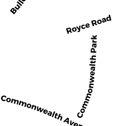
75 COMMONWEALTH PK WEST
Owner Information
FRANKLIN ARLENE S
75 COMMONWEALTH PK WEST
NEWTON, MA 02459


Property Details
75 COMMONWEALTH PK WEST is classified as a Single Family Residential (Colonial).
The primary structure on this property was built in 1925. There are 3,985ft2 of built area within this property. There is 2,573ft2 of residential/living space within this property. This property is listed as having 8 rooms.
75 COMMONWEALTH PK WEST is valued at $1,420,800. The land is valued at $868,600 and the structures are valued at $552,200.
This property is in Zone SR2. Confirm with local Zoning Board authorities to ensure there are no overlays or other easements on this property.
The most recent deed for 75 COMMONWEALTH PK WEST is recorded at the local registrar in Book 22173, Page 200. 75 COMMONWEALTH PK WEST was last sold on Monday, June 1, 1992 for $328,500.
Assessment data from fiscal year 2022.
Flood Data
According to the FEMA National Flood Hazard Layer, this property does not appear to be in a flood zone. It may also be in an area not yet reviewed. Nonetheless, confirm this information prior to taking any action.
To view the flood hazards around this property, create a FEMA "Firmette" Map of the area around 75 COMMONWEALTH PK WEST.
Broadband Internet Providers
| Provider | Type | Bandwidth (mbps) | |
|---|---|---|---|
| Comcast | Cable | 1000 | 35 |
| RCN | Cable | 500 | 20 |
| HughesNet | Satellite | 25 | 3 |
| GCI Communication Corp. | Satellite | 0 | 0 |
| T-Mobile | Fixed Wireless | 25 | 3 |
| VSAT Systems, LLC. | Satellite | 2 | 1 |
| Viasat Inc | Satellite | 100 | 3 |
| Verizon New England Inc. | DSL | 1 | 0 |
| Verizon New England Inc. | Fiber | 940 | 880 |
Broadband service provider data from December 2020.
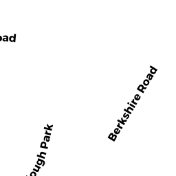
Adjacent Properties
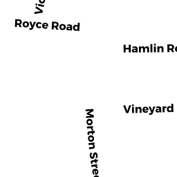
- 64 ROYCE RD
Single Family Residential owned by LIU XIAOHU - 79 COMMONWEALTH PK WEST
Single Family Residential owned by KROPP JOSEPH D & CYNTHIA L - 67 COMMONWEALTH PK WEST
Single Family Residential owned by SCHWARTZ ANDREA W - 75 ROYCE RD
Single Family Residential owned by BLOOSTEIN MARK J & LEVINSON ROBERT A & SMITH LAURA L TRS T/C - 86 BULLOUGH PK
Single Family Residential owned by SUMMIT JEFFREY A